Explore Our Areas of Service
Sectors and Fields Where FAERI Members Operate : FAERI members operate across diverse fields including agriculture, infrastructure, disaster management, filmmaking, environmental monitoring, law enforcement, logistics, mapping, and public safety, contributing to innovation and efficiency in every sector.
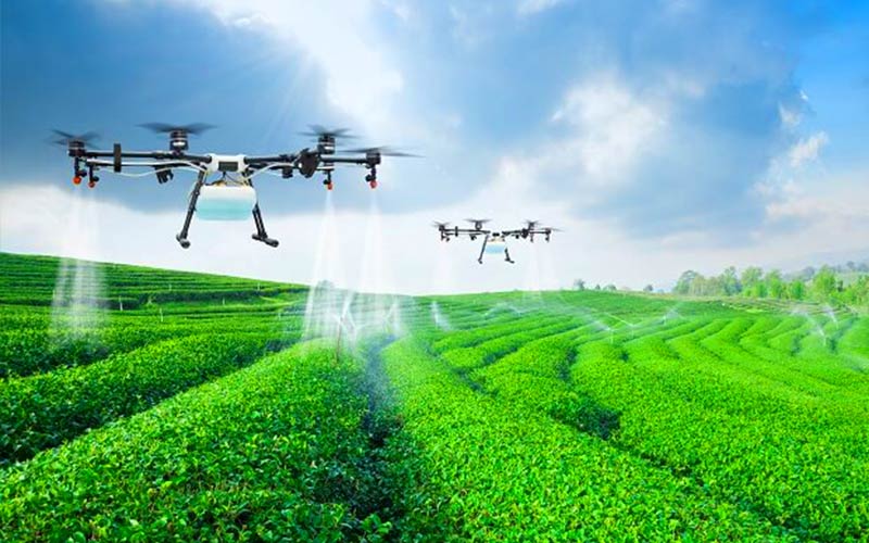
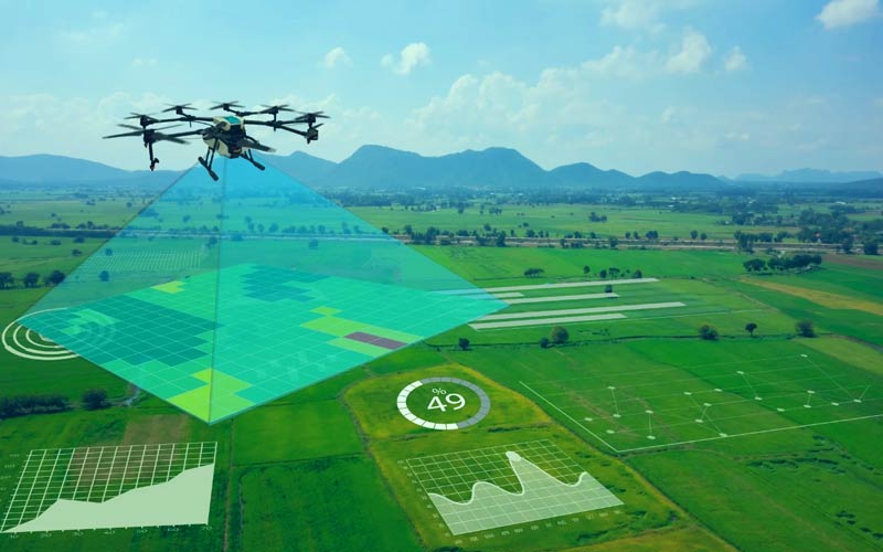
AGRICULTURE
FAERI members use drones for crop monitoring, spraying, and soil analysis, helping farmers increase yield, reduce costs, and adopt precision farming methods for smarter and more efficient agriculture.
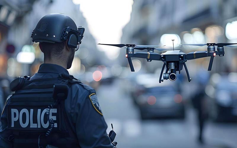
SURVEILLANCE & LAW ENFORCEMENT
Drones assist police and security forces with crowd monitoring, border patrol, and surveillance operations, improving public safety, evidence collection, and real-time situational awareness in urban and remote areas.
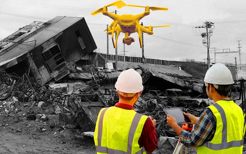
DISASTER MANAGEMENT
Members support emergency teams with aerial views for flood mapping, search and rescue, and damage assessment, enabling faster, safer, and more accurate disaster response and recovery efforts.
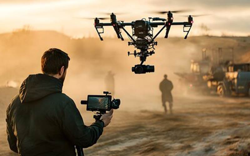
CINEMATOGRAPHY
FAERI’s drone pilots capture stunning aerial visuals for films, TV, advertisements, and documentaries, delivering creative, cinematic shots that elevate storytelling and production quality across visual media platforms.
MAPPING & SURVEY
Our members use drones for accurate land surveys, 3D mapping, and infrastructure planning, saving time and costs while offering detailed, high-resolution data for urban development and construction projects.

ENVIRONMENTAL MONITORING
FAERI supports climate and pollution tracking, deforestation alerts, and water resource management through drones, aiding scientists and agencies in protecting natural ecosystems and responding to environmental changes efficiently.

DELIVERY & LOGISTICS
Members operate drones for last-mile delivery, especially in remote areas, transporting medical supplies, documents, and lightweight packages quickly and safely, transforming the logistics and e-commerce industries.
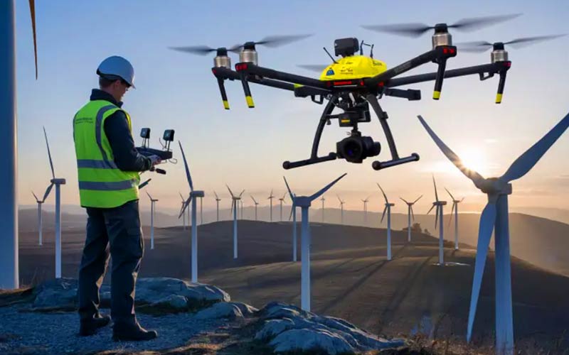
INDUSTRIAL INSPECTION
Drones are used in power plants, oil rigs, telecom towers, and factories for inspecting structures and equipment, improving safety, reducing downtime, and providing real-time data in difficult-to-reach areas.
WILDLIFE & FOREST SURVEILLANCE
Members assist in wildlife tracking, anti-poaching patrols, and forest cover monitoring, supporting conservation efforts and helping forest departments safeguard biodiversity using advanced drone technology.
How FAERI Supports These Service Areas
Bridging Skilled Drone Pilots and Real-World Demand
The Federation of Aerospace Engineers and Robotics Innovations (FAERI) connects trained drone operators, aerospace engineers, and robotics enthusiasts with the sectors that need them most. Rather than operating in a single niche, our members work across a wide range of fields, from agriculture and mapping to disaster response and industrial inspection. This breadth allows communities, businesses, and government agencies to access reliable drone and unmanned aerial vehicle (UAV) services from professionals who understand both the technology and the practical ground realities of working in India and Kerala.
Each area of service shares a common foundation: safe flight practices, accurate data capture, and responsible use of airspace. FAERI focuses on building this foundation through structured training, hands-on workshops, and peer knowledge sharing so that members are prepared to deliver consistent results, whether they are spraying a paddy field, surveying a construction site, or supporting an emergency rescue team.
Training, Research, and Field Deployment
FAERI's role in every service area spans three connected stages. First, we help individuals and clubs build core skills in drone operation, aerial data interpretation, and aerospace and robotics fundamentals. Second, we encourage research and development that adapts these technologies to local conditions, such as crop patterns specific to Indian farms, terrain challenges in survey work, or payload needs for remote-area logistics. Third, we support members as they move from learning into real deployments, connecting them with institutions, schools, and partners who can put their skills to productive use.
Because the same skills underpin many different applications, a member trained for agricultural spraying can often transition into mapping, inspection, or environmental monitoring with focused upskilling. This flexibility is central to FAERI's mission of growing a versatile, future-ready community of aerospace and robotics professionals who can respond to the evolving needs of public safety, industry, agriculture, and STEM education across the country.
Frequently Asked Questions
What areas of service do FAERI members operate in?
FAERI members work across many drone and UAV-based fields, including agriculture, mapping and survey, disaster management, surveillance and law enforcement support, aerial cinematography, environmental monitoring, delivery and logistics, industrial inspection, and wildlife and forest surveillance. The same core skills can be applied across several of these sectors.
How do drones help farmers in agriculture?
Drones allow farmers to monitor crop health, spray inputs precisely, and analyse soil and field conditions from above. This precision-farming approach can help reduce input waste, save time over manual methods, and support better decisions about where attention is needed in the field.
Does FAERI provide training for these service areas?
Yes. FAERI focuses on building practical skills through structured training, hands-on workshops, and knowledge sharing so members can operate drones safely and effectively. This prepares them to serve different sectors and to upskill as new applications emerge.
Can a single drone operator work across multiple sectors?
Often, yes. Because safe flight, accurate data capture, and responsible airspace use are common to most applications, a member trained in one area, such as agricultural spraying, can typically move into related fields like mapping, inspection, or environmental monitoring with focused additional training.
How are drones used in disaster management and public safety?
Drones provide rapid aerial views that support flood mapping, search and rescue, and damage assessment. They help emergency and security teams gain real-time situational awareness, reach difficult locations safely, and respond more quickly during critical situations.
How can I become part of FAERI and offer these services?
You can join FAERI through individual membership or register a club or organization. Membership connects you with training, a community of aerospace and robotics professionals, and opportunities to apply your skills across these service areas. Visit the membership and registration pages on this site to get started.