India’s First Flood Mapping Study on Pamba River Completed by FAERI for Aranmula Heritage Trust
The Pamba River flood mapping study, completed by the Federation of Aerospace Engineers and Robotics Innovations (FAERI) for the Aranmula Heritage Trust, stands as India's first comprehensive drone-based flood assessment of its kind. By combining unmanned aerial systems with geospatial analysis, the project demonstrated how modern aerospace technology can directly support environmental protection, disaster preparedness, and the safeguarding of culturally significant landscapes.
A Landmark in Drone-Based Environmental Research
The study focused on the Pamba River, a region historically vulnerable to seasonal floods and one that carries considerable ecological, cultural, and infrastructural importance. Recurring flood events along major river systems can threaten communities, farmland, riverbanks, and heritage sites, making accurate, up-to-date terrain intelligence essential for planning and protection.
By treating the Pamba basin as a real-world case study, FAERI showcased how Unmanned Aerial Vehicle (UAV) technology can move beyond demonstration flights into practical, high-impact applications that serve both people and the environment.
How the Flood Mapping Was Carried Out
FAERI's expert team relied on a combination of advanced tools and techniques to build a detailed picture of the river region:
- UAV technologies to survey large and difficult-to-access stretches of terrain safely and efficiently.
- High-resolution aerial imaging to capture fine detail across the landscape.
- GIS-based analytics to convert raw imagery into actionable geospatial insights.
Together, these methods were used to map flood-prone zones, water flow patterns, terrain variations, and areas requiring urgent mitigation efforts. The resulting data-driven insights were designed to support long-term disaster preparedness, riverbank conservation, and strategic planning for the Aranmula region.
Why Aerial Data Matters for Flood Resilience
Drone-collected data and GIS modelling are increasingly valued worldwide for environmental monitoring because they offer rapid, detailed, and repeatable surveys. For flood-sensitive regions, this kind of intelligence helps planners understand how water moves across the land and where protective measures are most needed, contributing to safer and more resilient development.
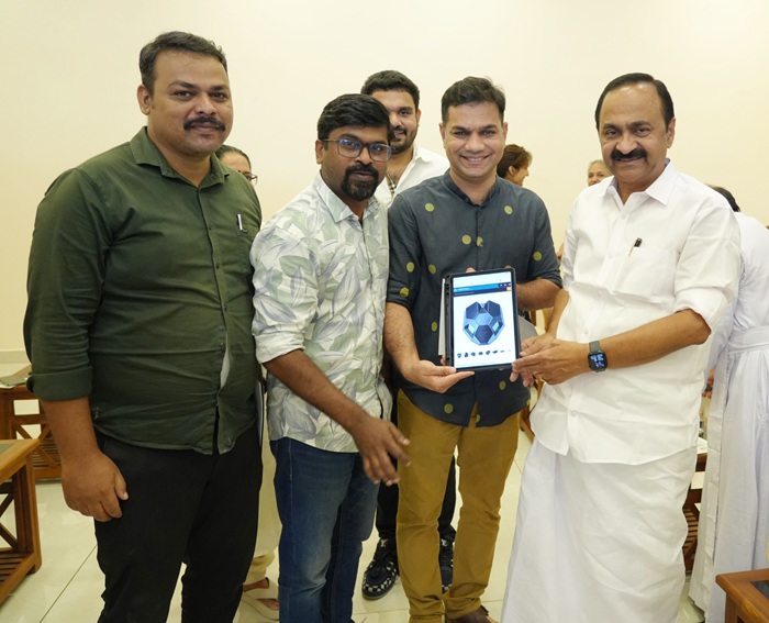
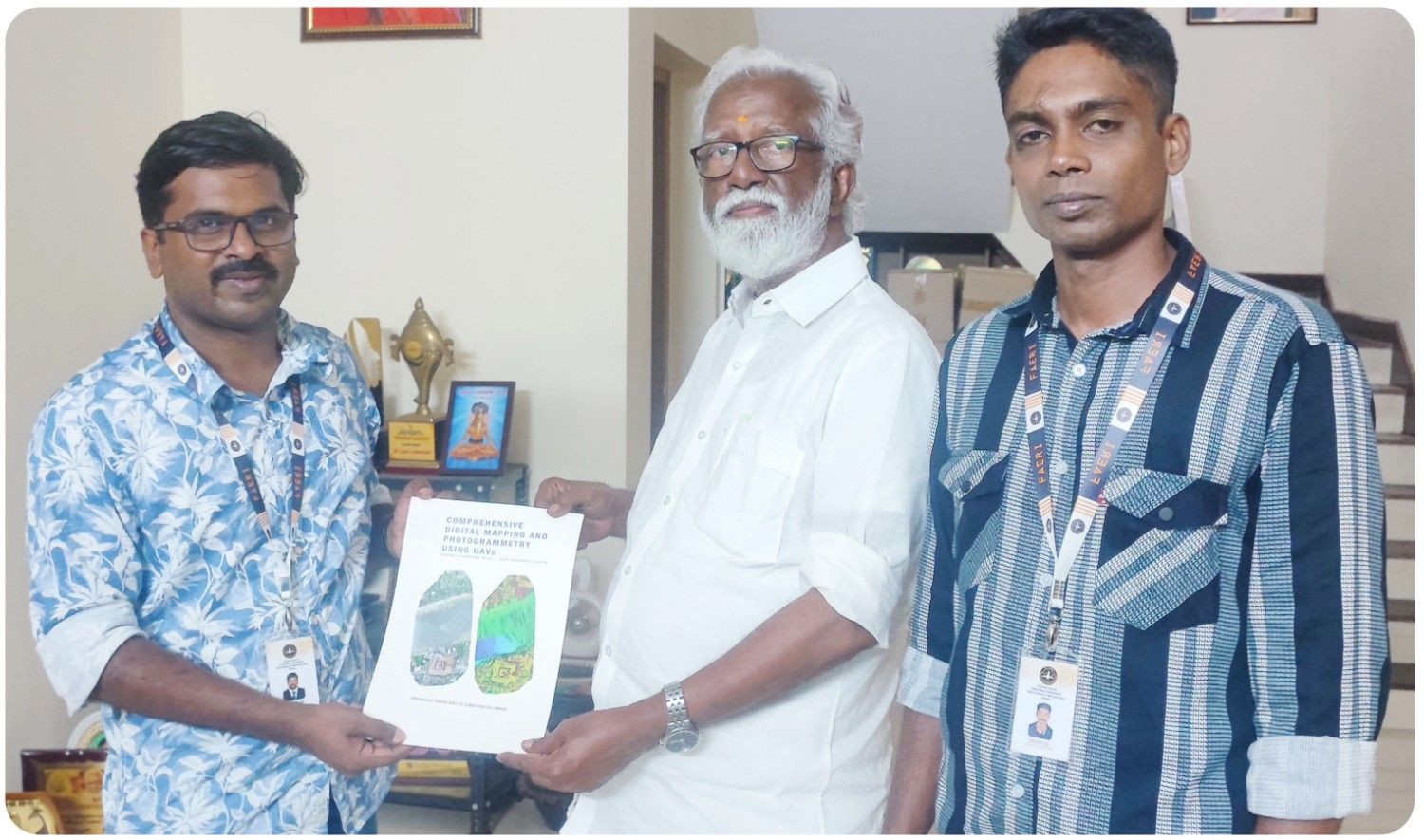
Report Handed Over to the Aranmula Heritage Trust
The final report was officially handed over to a trustee of the Aranmula Heritage Trust, former Governor of Mizoram, Shri Kummanam Rajasekharan. His involvement underscored the importance of adopting modern technology to preserve heritage sites and ensure community safety.
This pioneering initiative positions FAERI as a leader in utilizing drone technology for environmental research and disaster management, showcasing the potential of UAV systems in shaping sustainable and resilient development strategies across India.
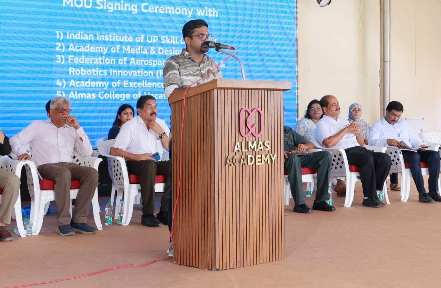
Advancing FAERI's Mission
As a federation dedicated to promoting aerospace and robotics education and innovation across India, FAERI works to bridge advanced engineering with real-world problem solving. The Pamba River flood mapping study reflects that mission, illustrating how drones, imaging, and analytics can be applied to protect heritage, strengthen disaster readiness, and guide sustainable planning for the future.
Frequently Asked Questions
What was India's first comprehensive flood mapping study about?
It was a drone-based flood mapping study carried out by FAERI for the Aranmula Heritage Trust, focused on the Pamba River. It mapped flood-prone zones, water flow patterns, terrain variations, and areas needing urgent mitigation.
Which river was the focus of the FAERI flood mapping study?
The study focused on the Pamba River, a region historically vulnerable to seasonal floods with significant ecological, cultural, and infrastructural relevance.
What technologies did FAERI use for the study?
FAERI's team used advanced Unmanned Aerial Vehicle (UAV) technologies, high-resolution aerial imaging, and GIS-based analytics to generate the flood map and related insights.
Who received the final report of the study?
The final report was officially handed over to a trustee of the Aranmula Heritage Trust, former Governor of Mizoram, Shri Kummanam Rajasekharan.
What is the purpose of the data generated by the study?
The data-driven insights are intended to support long-term disaster preparedness, riverbank conservation, and strategic planning for the Aranmula region.
Related News